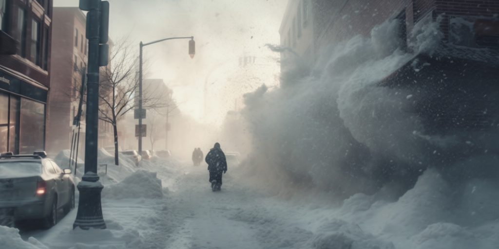
A blizzard represents a formidable snowstorm characterized by forceful winds, frigid temperatures, and diminished visibility, often leading to perilous and life-threatening situations. These intense weather phenomena manifest in various regions worldwide, especially in higher latitudes and on the sheltered sides of mountain ranges. This article delves into the meteorological processes that give rise to blizzards, examining the essential conditions necessary for their formation and the critical factors that contribute to their heightened severity.
The Essential Elements of a Blizzard
Blizzards go beyond being mere sizable snowstorms; they are discernible by the intensity of their winds and the limited visibility they impose. To officially classify as a blizzard, a storm must exhibit sustained winds or frequent gusts exceeding 35 mph, accompanied by blowing or drifting snow that reduces visibility to 1/4 mile or less. These conditions must persist for a minimum duration of three hours. To comprehend the causes behind blizzards, one must grasp the interplay of three fundamental components: snowfall, wind strength, and reduced visibility.
1. Snow
To initiate a blizzard, the presence of snow is essential. Snow materializes when the atmosphere harbors moisture and the air temperature descends below the freezing point of water. This phenomenon can transpire across different layers of the atmosphere, predominantly transpiring within clouds where water vapor undergoes condensation, transforming into minuscule ice crystals. These crystals have the propensity to unite, thereby giving rise to intricate snowflakes that gracefully descend to the ground once their mass reaches a critical threshold.
The occurrence of snow necessitates the fulfillment of the following conditions:
- Below-freezing temperatures: In order for snow to take shape, it is imperative that the air temperature reaches or falls below the freezing point of 32°F (0°C);
- Presence of moisture: Adequate moisture in the air is a crucial requirement for the formation of snow. This moisture is commonly sourced from a neighboring body of water;
- Cloud formation: Lastly, the formation of clouds is necessary for the process of snowfall. Clouds serve as a sort of “factory” where the conditions are conducive for the creation and growth of ice crystals, which eventually transform into snowflakes.
2. Wind
The distinguishing characteristic of a blizzard lies in its forceful and persistent winds, primarily influenced by fluctuations in atmospheric pressure. When a substantial disparity in pressure occurs over a relatively confined region, it gives rise to a pressure gradient, prompting the movement of air from areas of high pressure to those of low pressure, consequently generating wind.
In the context of blizzards, this pressure contrast is commonly engendered by the simultaneous presence of a low-pressure system, known as a cyclone, and a high-pressure system. The interaction between these two systems amplifies the pressure differences, intensifying the speed of the winds experienced during a blizzard.
| Factors | Description |
|---|---|
| Atmospheric Pressure Differences | Variances in atmospheric pressure initiate the generation of wind. |
| Pressure Gradient | A significant disparity in pressure within a confined area compels the movement of air from areas of high pressure to those of low pressure. |
| System Interactions | When a low-pressure system, also known as a cyclone, and a high-pressure system coincide, it intensifies the pressure disparities, leading to an escalation in wind speeds. |
3. Reduced Visibility
During a blizzard, visibility is significantly diminished, primarily caused by the blowing or drifting of snow due to strong winds. The degree of reduced visibility is influenced by three essential factors: the strength of the wind, the amount of snow present, and the characteristics of the snow itself. These elements collaborate to determine the extent of impaired visibility experienced during a blizzard.
| Factors | Description |
|---|---|
| Wind Intensity | The forceful winds uplift snow from the ground, propelling it into the air. |
| Snow Availability | The quantity of snow accumulated on the ground determines the availability of snow that can be lifted into the air. |
| Snow Type | Certain types of snow, such as light and powdery snow, are more prone to being blown about by the wind. |
Blizzard-forming Weather Patterns

Comprehending the causes of blizzards necessitates an understanding of specific weather patterns, with one of the most prevalent being mid-latitude cyclones. These cyclones are commonly linked to blizzard occurrences in the northern hemisphere.
Mid-latitude cyclones, also known as extratropical cyclones, form along the polar front – the boundary between warm tropical air masses and cold polar air masses. These cyclones typically form when a wave develops on the polar front, creating a region of low pressure. This low-pressure system can draw in cold air from the north and warm air from the south, creating conditions favorable for snow formation and strong winds.
Table: Typical Mid-Latitude Cyclone Formation Process
| Stage | Description |
|---|---|
| Stage 1 | A wave forms on the polar front, with cold air to the north and warm air to the south |
| Stage 2 | The wave amplifies, creating a low-pressure system at the junction of the cold and warm air masses |
| Stage 3 | The cyclone matures, with distinct warm and cold fronts, strong winds, and potential snow formation |
| Stage 4 | The cyclone occludes, or ‘cuts off’, as the cold front catches up to the warm front, potentially causing heavy snow and strong winds |
| Stage 5 | The cyclone dissipates as it loses its source of energy, typically leading to a decrease in wind speeds and snowfall |
Conclusion
Blizzards are complex weather phenomena that are caused by a combination of meteorological conditions and atmospheric patterns. Understanding these causes can help us better predict blizzards and prepare for them, potentially reducing their impact on our lives and society.
FAQs
This is primarily because the conditions necessary for blizzard formation – including below-freezing temperatures and the potential for snowfall – are more common in the winter.
Certain areas are more prone to blizzards due to their geographic location. Regions near large bodies of water are more likely to have the necessary moisture for snow formation, and regions at higher latitudes or altitudes are more likely to have below-freezing temperatures.
Yes, with modern meteorology, blizzards can often be predicted several days in advance. Forecasters look for the development of low-pressure systems and monitor temperature and moisture conditions to predict potential blizzards.
It’s important to prepare by stocking up on necessary supplies, including food, water, and warm clothing. You should also make plans to stay indoors and avoid travel during the blizzard due to the dangerous conditions it can cause.


